
Prince George has endured another week of winter, breaking a few records in the process, but the promise of spring is on the horizon.
Tuesday, April 19 saw a snowfall warning for the Prince George area with 15 centimetres expected to hit the ground before turning to flurried in the afternoon.
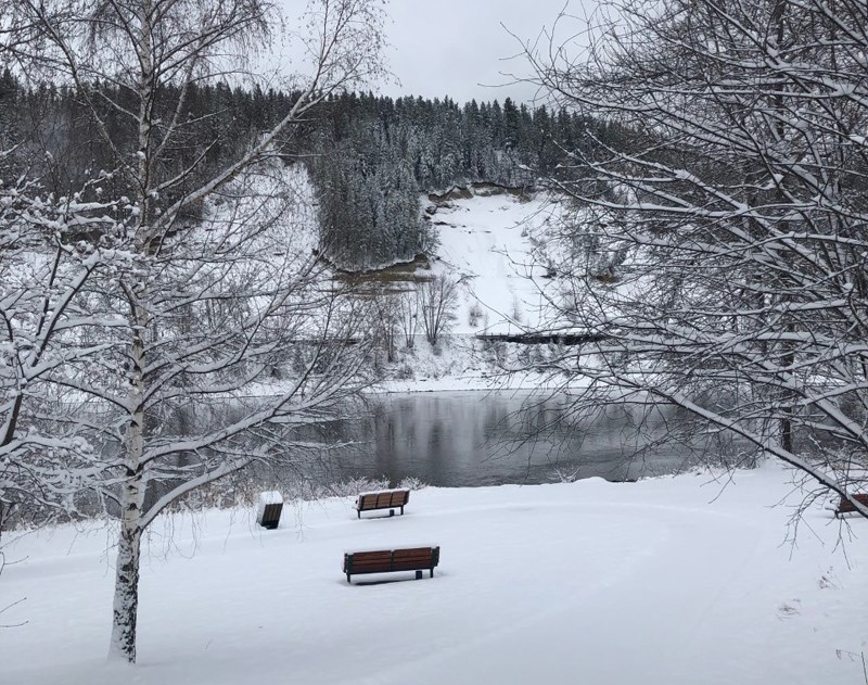
“Prince George did receive a near-record snowfall as parts of the region received 10 to 15 centimeters and at the Prince George airport itself, it did record 11 centimeters of snow for that day,” said Derek Lee, a meteorologist with Environment Canada.
The previous record for snowfall on April 19 was 4.2 centimetres set in 1980.
“It's potentially a record for the amount of snowfall that fell. However, with the amount of snow on the ground it has been observed before that we did have 11 cm way back in 2013 as well on the ground,” adds Lee.
He said the mid-April snowfall and cold weather was the result of an arctic influence of cold air where the average temperature was about at least 10 degrees below average from what we normally see this time of year.
“That preconditioning a cold air from the north really helped keep the surface temperatures low so as a system kind of moved in from the Pacific off the long weekend that brought moisture, but because the surface temperatures are so cold and the freezing levels are so low, it actually was able to bring snow all the way to the surface,” explained Lee.
Prince George broke a record for cold temperature on April 13 with a new record of -11 C which broke the previous record of -10.5 from 1981. Then on April 16, a low temperature of -9.5 C was recorded that day which just broke the previous low record of -9.4 C from 1927.
“Not too much of a difference, but definitely was cold enough for that last week of time that we did end up seeing a record being broken for low temperatures,” added Lee.
Going forward Lee says it is possible Prince George will see flurries lingering especially when it falls overnight or into the early morning times but overall, for the daytime temperature outlook Prince George area will be back to its normal trend.
The normal for this time of year is 13 C degrees or so with a low of 0 degrees.
“Coming into the weekend we're going to see temperatures back to the mid teens. So, 14 C to 15 C this weekend and then moving forward to next week we're going to kind of still stay in the teens but there's going to be more precipitation returning too.”
Lee noted we cannot rule out the chance of more snow as it’s possible to see snow occurring until the first week of May.


