
Firefighters battling to get a handle on the Christie Mountain wildfire burning out of control between OK Falls and Penticton could catch a break from Mother Nature today (Aug. 19).
Temperatures around the Southern Interior are expected to begin falling from the record-setting highs of the upper 30s we've experienced over the past several days to the low 30s today and closer to seasonal averages (27 C) starting Thursday (Aug. 20).
Environment Canada meteorologist Doug Lundquist tells Castanet News heavier winds from the south which helped to fan the Christie Mountain wildfire Tuesday night should be replaced with more moderate winds from the north today.
"We are expecting north winds today of between 10 and 20 kilometres an hour," said Lundquist.
However, he says those winds are expected to shift, coming from a southerly direction on Thursday.
Friday, Lundquist says, could be a danger day with more unsettled conditions bringing stronger winds from the south, with the chance of thunderstorms and only a little precipitation, with two to five millimetres forecast.
Lundquist expects the Okanagan to remain unsettled through the weekend and into early next week, which could also mean stronger winds, however, temperatures are only expected to reach between 24 and 28 Celsius.
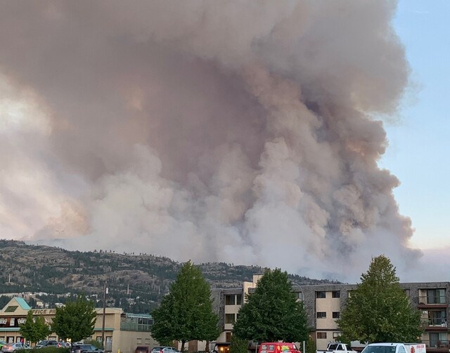
The Christie Mountain wildfire, which was first spotted early Tuesday afternoon just north of OK Falls, has grown to 1,000 hectares in size.
The fire has prompted evacuation orders for 319 properties in the Heritage Hills neighbourhood, while the City of Penticton has placed 3,669 properties on evacuation alert in the south end of the city.
Upper Carmi residents are also on alert.


