
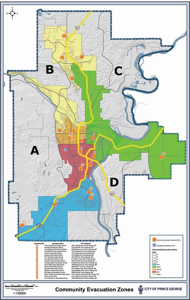
The city has released a map showing residents where to turn in the event of an emergency evacuation.
It depicts 18 assembly points, all of them schools, divides the city into nine zones - five of them consisting of the city's garbage collection zones and four where the service currently does not exist.
"The map is based largely upon the current city garbage collection map, due to the fact that residents are already familiar with the map's coloured zones," the city said in a press release.
The schools were chosen as assembly points "based on their centrality and traffic flow in each evacuation zone."
The map also shows the location of the city's reception centre for evacuees at Exhibition Park.
A high resolution copy is available for download on the city's emergency response web page.
And copies will be mailed out to all residents next year.
Also, on May 15, the city will be hosting an open house to to show the progress of the Emergency Program and Community Wildfire Protection Plan and gather feedback. Further event details will be released when they are available.
The work is part of developing a strategic plan aimed at improving the city's readiness for all foreseeable emergencies. A progress update will be presented at this Monday's city council meeting.


