
Kiss winter goodbye. Spring has arrived.
Officially it happens at 2:28 p.m. Monday, but you just have to step outside into that sunshine and warmth to know Prince George is basking in the glow of the change of season.
Even Sunday, when the mercury hit 10 C, that came after an overnight low of -12 C. Those cold overnight lows have kept the snow and ice from melting rapidly.
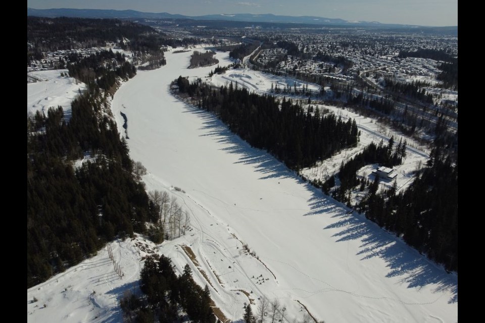
Mike Rommel noticed that when he flew over the city on Thursday and took photos he posted on Facebook. It showed the Nechako River still completely frozen over in most parts as it meanders through Prince George to flow into the Fraser. Rommel suggested in his post this might be the latest ever for that part of the river to still be solid ice. At the very least, this year will rank as one of the latest spring breakups to happen in Prince George.
But that river ice will almost certainly get eroded this week, with sunny skies and above average temperatures in the forecast at least through Thursday. We’re heading for another high of 10 C today and it won’t be that cold overnight with a low of -5 C expected Tuesday morning.
Highs will remain in the 9-10 C range for the next four days, with lows no colder than -3 C forecast for Wed-Friday. There is a chance of flurries or rain on Friday with a high of only 3 C expected, but the sunshine is predicted to return for the weekend with highs of 6 or 7 C.
The spring (vernal) equinox is the day the sun moves northward across the celestial equator and it marks a day of equal daylight and nighttime hours.


