
A streak of exceptionally-warm weather produced a record-high temperature on Monday.
The thermometer struck 13 C, eclipsing the old standard for Nov. 7 of 11.7 C set in 1917, Environment Canada meteorologist Matt MacDonald said.
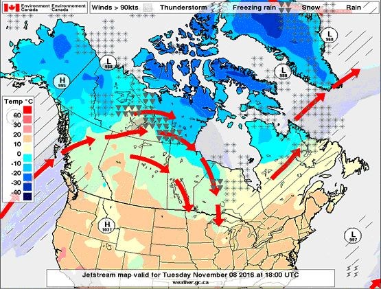
The typical temperature for this time of year is just 3 C but thanks to the so-called "pineapple express," significantly warmer weather has been the pattern for the last few days. The jetstream is currently flowing to the west and north of the city - and the province - allowing warm air to move up from the United States.
The forecast high in the southern Interior is 18 C for Tuesday, MacDonald noted.
He said the the trend will continue for the next few days - the temperature for Tuesday is expected to reach 14 C although that's still short of the record 17.2 for Nov. 8 seen in 1917.
"I think come Thursday or Friday, we'll get into a more showery pattern, the temperatures stay quite mild," MacDonald said. "And then come the weekend, we'll slowly be returning to seasonal temperatures."
The long-range forecast calls for a colder winter last year as El Nino, produced by a bout of exceptionally warm Pacific water that appears just off the equator from time to time, gives way to its counterpoint, La Nina.
MacDonald is hedging his bets, however.
"There's about a 60 per cent chance of a weak La Nina developing and I've been trying to emphasize to people that there are years when the climate indices are very strong and that really increases our confidence in the seasonal forecast," MacDonald said.
"But this winter is not one of those years...it doesn't stack the cards as strongly as last winter when we had a record-strong El Nino. So I would expect slightly cooler-than-normal conditions and forecasting precipitation or snow in the long range is always kind of impossible."

