
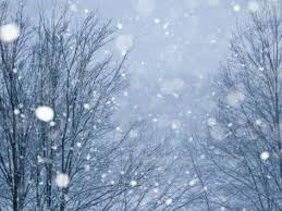
A record-setting amount of snow fell on the city Friday.
In all, 20 cm descended, edging out the old record for Jan. 30 of 19 cm, set in 1957, according to Environment Canada meteorologist Matthew MacDonald.
The dump followed a streak of weather that, although unseasonably warm, fell short of record setting. The warmest it got was 6.0 C on Jan. 26, which was still 2.5 C below the record, set in 2006.
That said, it added up to a milder-than-usual January. The mean temperature for the month was -4.6 C, compared to the normal of -7.9 C.
MacDonald called the difference "quite significant" and pointed to warm Pacific waters off B.C.'s coast.
"They've been two to three degrees above normal throughout the entire winter," he said. "Of course, all our weather comes in from the west and it's resulted in a quite mild winter so far."
The mean temperature for December to January has translated into the seventh warmest winter for records dating back to 1943.
With the Canada Winter Games nearing, MacDonald said the forecast is looking good for the coming week.
"After a very mild December and January, we're finally into a cooler pattern," MacDonald said. "The Arctic air moved south over the weekend and throughout the week, we're going to be seeing more seasonal temperatures."
Normals for this time of year are highs of -1 C and lows of -10 C, but throughout the week, the highs will be around -5 C and the lows around -15 C. A "good storm" is also in the cards this Thursday and Friday with 10 to 15 cm of snow expected.
Looking at the extended forecast, which MacDonald said need to be taken with a grain of salt but temperatures are expected to climb back to near normal, with highs of 0 C and lows of -7 C or -8 C.
"We're not seeing any big, big warming at present time so I think this is all good news for the Games," MacDonald said.


