
The city is asking homeowners to pitch in while workers get set to deal with the fallout from melting snow as the temperature takes a turn for the warmer over the next few days.
Residents are encouraged to report any large puddles or flooding by calling 250-561-7600 or emailing [email protected].
They can also help out by ensuring that debris such as leaves, plastic, or paper are not covering nearby storm drains.
They're also reminded that it's the property owners' responsibility to procure pumps and other materials and tools necessary to protect their properties from damage due to flooding.
"Sandbagging, tarping, ditching, and clearing clogged drains and culverts are all effective measures for reducing the risk of flooding," city utilities operations supervisor Jon LaFontaine said.
"Residents with houses at risk for basement flooding are advised to have sump pumps available and to be prepared to work with neighbours to divert water to the closest storm drains."
Do not use sprinklers to melt snow and ice - you could be fined under city bylaws.
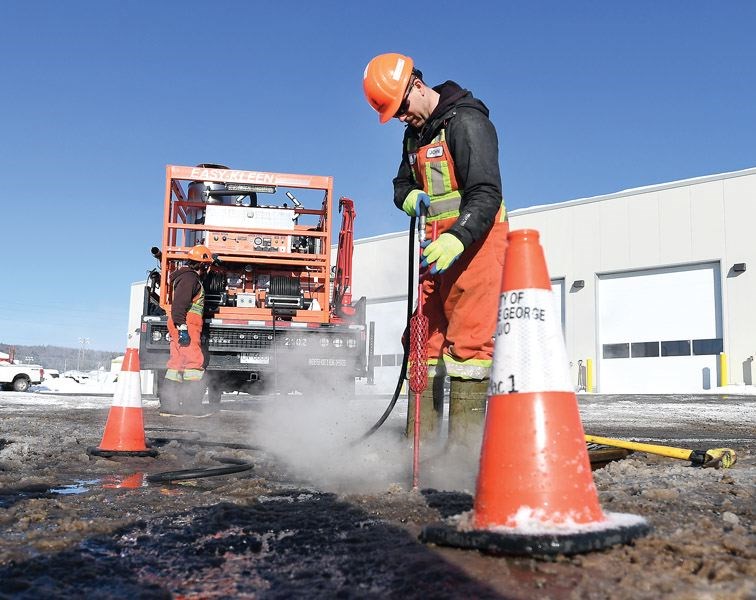
The division's crew of about 40 people will be out keeping their eyes on the 5,500-plus storm drains across the city. They use a variety of means including GPS mapping and metal detectors to locate drains and steel grates buried under snow and ice.
The city's roads and fleet division also supply crews and equipment, including snow plows, to address open ditch and culvert flooding and drainage issues.
"Flooding can happen for a variety of reasons, but one of the most common causes is surface water flooding, which is typically caused by meltwater on frozen ground with nowhere to go," LaFontaine said. "Another cause is simply system overload. Large melts and rain can cause storm systems to overload as they cannot drain the water fast enough."
Daily highs are forecast to reach 6-7 C over the weekend and then rise to 12 C by Tuesday, according to Environment Canada.
Meanwhile, February's deluge of snow noticeably boosted the area's snowpack indices according to the latest bulletin from the provincial government's River Forecast Centre. As of March 1, the snowpack for Upper Fraser West stood at 138 per cent, up from 92 per cent as of February 1. For Upper Fraser Valley East, it was 108 per cent, up from 101 per cent and for the Nechako, it was 95 per cent, up from 84 per cent.
However, the seasonal runoff forecast for the Upper Fraser basin remains near normal, according to the River Forecast Centre. Nearly 80 per cent of the annual B.C. snow pack typically accumulates by early March.
University of Northern British Columbia environmental studies professor Stephen Dery said the situation over the coming week is shaping up to be "very interesting."
"Given all the recent snow and now the warming temperatures, we may see a rapid melt of the snowpack over the next week," he said. "Certainly in the smaller streams in and around Prince George I would not be surprised there would be some localize flooding, especially in areas where the ground remains frozen or where drains are covered in snow and ice.
"I think the concern here is how rapidly we may expect the temperatures to warm and stay well above freezing during daytime. At least we are not concerned about a possible rain on snow event in the next week."
As for the Fraser and Nechako, Dery said the rivers' levels are low "and this initial pulse of meltwater will raise their levels but perhaps not lead to flooding. "There’s lots of ice on the Nechako though, so we’ll need to see if this leads to any rise in water levels. Anyway, something to monitor in the next little while."


