
That lovely warm taste of spring that had Prince George basking in the sunshine over the weekend is going to continue for at least another day.
We’re heading for a high of 14 C this afternoon under blue skies with only a slight breeze.
If it does get that warm that would break the record high of 13.4 C set in 1931.
Saturday was record-setter in the city when Prince George Airport reached a high of 16.8 C, bettering the old record of 13.3 C set in 1947. On Sunday the high of 20.2 C annihilated the former record high of 13.3 C, set in 1941.
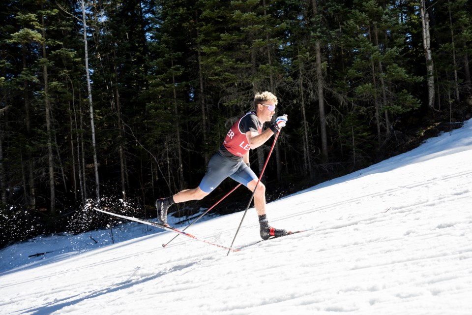
That made for sloppy race conditions for the cross-country skiers from 16 countries competing in the final two days of the Para Nordic World Cup Finals at Otway Nordic Centre, but the balmy weather made it a perfect day spectators, volunteers and race officials.
It was even warmer closer to downtown. The thermometer at the Massey Drive weather station reached 17.8 C on Saturday and 21.1 C Sunday afternoon at 3 p.m.
The downside of all that is the high pressure and calm conditions that are keeping the clouds away is keeping the dust from road traffic and industrial activity from dispersing. Large particles suspended in the atmosphere are harmful to human, especially for those who have respiratory problems or chronic health conditions.
The dust advisory Environment Canada issued on Friday remains in effect and people should avoid strenuous activity until it clears.
Spring arrives Tuesday at 8:06 PDT. It will be mostly cloudy that day but still warmer than normal with a high of 8 C and allow of -3 C predicted.
Snow and a return to wintery temperatures is in the forecast for Wednesday. There’s a 40 per cent chance of snow that day with a high of 4 C And low of -10 C.
The double-digit minimum temperatures will persist from Thursday-Saturday with lows around -13 to -14 C and highs ranging from 0 C to 2 C.
“It dips down and then it looks like near the end of the weekend it goes back to near-seasonal,” said Environment Canada meteorologist Derek Lee. “It’s only a short period of Wednesday to Saturday that you may see cooler temperatures in the are,a but I don’t see much snow. It’ll be a sprinkle, it’s not like a snowstorm.”


