
This week's hike is one of the most popular in our region, and for a good reason. Mount Pope is one of the highest peaks in the area, providing a sweeping panoramic 360 degree of the interior plateau.
These views include Stuart Lake and Battleship Island to the south and the Omineca Range to the north. The mountain is named after Major Franklin L. Pope who was surveying in area in 1865 and got lost on the mountain while exploring the area for a telegraph line.
Directions
Drive to the town of Vanderhoof and continue on for seven kilometres to the junction with Highway 37 north to Fort St James. Turn right onto Highway 37 and drive 55 kilometres to the town of Fort St James.
From the bridge that crosses the Stuart River at the entrance to the town drive 5.5 kilometres through the town and turn left onto Stones Bay Road. Drive 4.1 kilometres down this road and turn right into the trailhead parking lot.
Trail description
The well marked and well used trail climbs steadily for the first 3.0 kilometres. There is a nice viewpoint at 1.4 kilometres with views of Stuart Lake in the distance. The trail descends for a short section around 3.5 kilometres before ascending again the rest of the way to the peak. After 5.0 kilometres there is another viewpoint with better views of Stuart Lake and the Nechako Plateau.
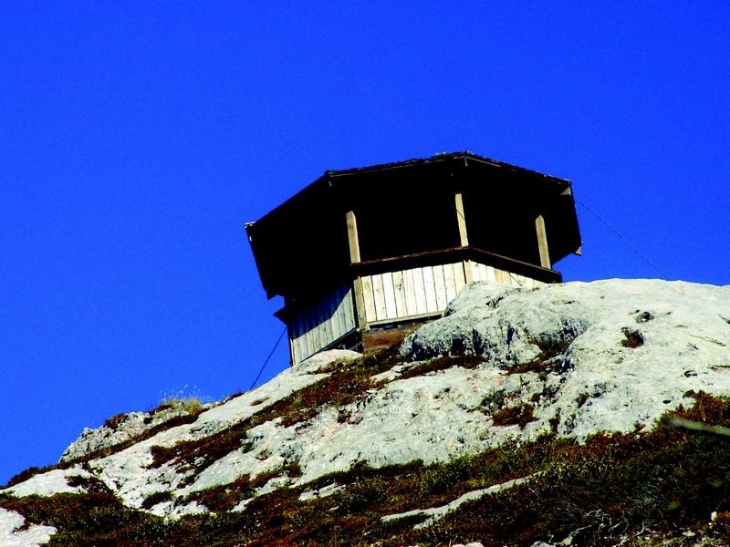
About 160 m below the summit there is a rest area with picnic tables. The final section climbs up a rocky knoll to the top where a gazebo is situated. There are great views of Pinchi and Tezzeron Lakes to the north and Stuart Lake and Battleship Island to the south. The gazebo sits on a rocky outcropping on the peak of Pope Mountain. The trail has a south facing aspect which allows for early spring hiking.
For more information on this hike including airphotos, GPS co-ordinates and trail photos refer the book Hiking Central BC which is available at local bookstores.


