
This week's hike is probably the most popular hike in our region. It is typically the first hike that many newcomers to our city attempt, and they probably do not realize they are climbing an old volcanic plug. The views from the top of this short but steep mountain provide incredible views in all directions. Summit Lake lies to the south and Teapot's sister mountain; Coffeepot lies to the north.
Directions
From the corner of Chief Lake Road and Highway 97 in Prince George, drive 41.5 kilometres north and turn left on to Tallus Road. Follow Tallus Road for 950 metres and turn right on to the Caine Creek Forest Service Road. Follow this road for 3.3 kilometres to the trailhead parking lot which is on the right side of the road (200 metres past the Crooked River Bridge). The trailhead is situated in a pullout just off Caine Creek Forest Road. The trail leaves the parking lot towards the northwest.
Trail Description
The trail follows an old road for the first 100 metres where it opens up into a small clearing. The trail then starts to ascend steeply through the large angular basalt columns. These columns are usually five or six sided and were formed through the slow cooling of lava flows.
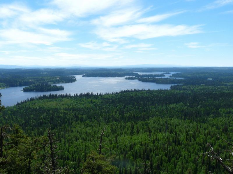
It is 800 metres to the top of Teapot Mountain where a loop trail is reached. This trail winds around the perimeter of Teapot Mountain. Taking the right or left fork will lead back to this junction. It is an easy walk along the top with great views of the region as this is the highest point in the area. To the south, Summit Lake and a variety of other small lakes are the predominant features. To the west a large swamp lies below the mountain. To the north and east the slow moving Crooked River meanders its way northward.
For more information on this hike and others in this area, including airphotos, maps, GPS coordinates and trail photos, refer to the book Hiking North Central BC which is available at local bookstores.


