
This week's hike to Canty Lake is the first good grunt of the season and it will put your legs through an early season burn.
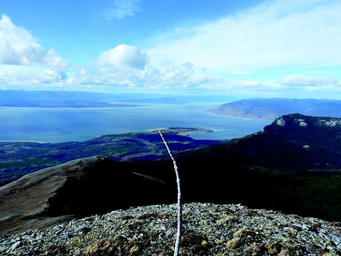
It is not a very well known trail so you will most likely have it all to yourself and an opportunity to enjoy the finest views anywhere of Williston Lake.
This trail is situated in a unique part of our region and overlooks the largest lake in our province.
Directions
In the town of Mackenzie, drive north on Mackenzie Blvd from Centennial Drive. The gravel road starts at 7.5 kilometres. At 9.5 kilometres a four way junction is reached. Proceed straight through the junction and head north.
The road is called the Parsnip West FSR. At 88.2 kilometres from Mackenzie or 91 kilometres on the road markers turn right onto another small forest road. At 1.9 kilometres on this road stay right. The parking area is reached at three kilometres.
Trail Description
This well marked trail climbs steeply to a small lake perched on flat area on the side of the Misinchinka Range. There is a small recreation site at the lake as well as options to explore the ridges to the north and south of the lake.
The trail starts off level for the first half kilometre and then begins the steep ascent. A unique set of springs with different mosses and pools are reached near the beginning of the climb.
A viewpoint is reached at 2.2 kilometres. This point provides nice views of Williston Lake and also a place to rest your legs.
The trail levels off at 2.7 kilometres and this is also the junction where the routes to the north and south take off. The trail reaches the lake 200 metres further. The lake has a primitive recreation site with a picnic table and outhouse. The site lies adjacent to the lake and below the towering Mt. Selwyn to the east.
From the junction at 2.7 kilometres there are two routes that head north to the Peace Peak and the south to a beautiful alpine ridge and peak. Both routes can be difficult to follow as the trails are faint in spots.
The trail to the north winds along a ridge for 2.5 kilometres to the Peace Peak at 5,636 feet. The trail to the south climbs gradually for 2.2 kilometres to the first flat topped peak and then a further 900 metres to a steep rocky point to the west at 6,453 feet.
There are many opportunities to explore the ridges and alpine from this first peak
For more information on this hike including airphotos, maps, GPS co-ordinates and trail photos refer the book Hiking Central BC.


