
This week's hike is to Muskeg Falls.
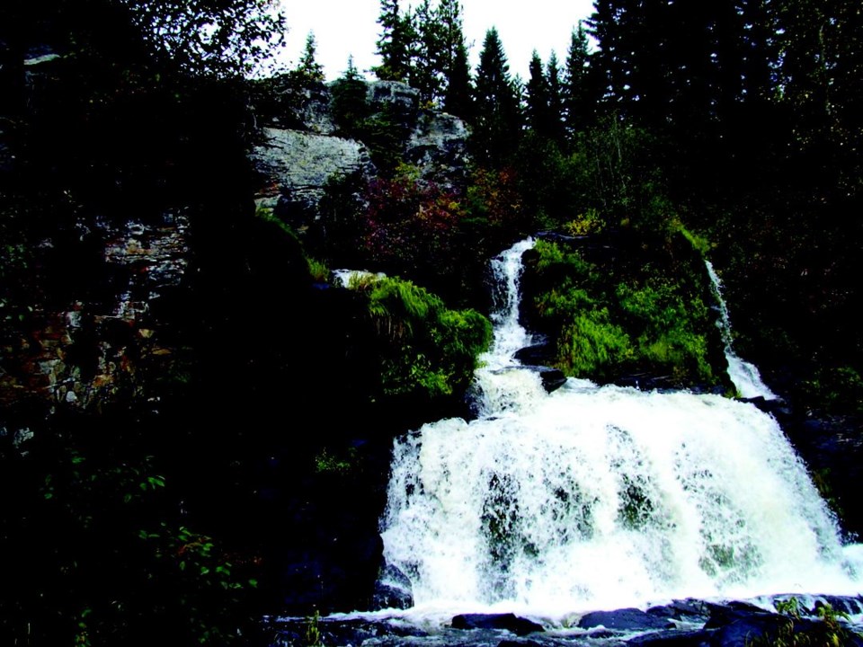
These rarely visited falls carve their way through a narrow canyon and then cascade down a series of cataracts.
The relatively short hike makes this destination suitable for the whole family.
This region also has many lakes and rivers enroute to the falls so make a day of it do some exploring.
By the way, there is no muskeg to cross or hike along so do not worry about getting wet feet on this one.
Directions
From the corner of Chief Lake Road and Highway 97 in Prince George, drive 55 km north and turn left onto the 100 Road.
Cross the railway tracks, and follow this road for 11.5 kilometres to the 112.5 kilometre road marker.
At this point the road joins with the 200 Road and now becomes the 200 Road or Davie-Muskeg Road.
Drive 47 kilometres along this forest road to the 259.5 kilometre road marker.
The parking lot is on the right side. The trailhead leaves the parking lot on the north side. It is marked by a large Muskeg River Falls trail sign.
Trail Description
The trail is well marked and relatively flat for the whole length. It passes through a pine and spruce forest as well as crossing over rocky outcroppings.
After 950 metres, the trail crosses a short boardwalk section.
The final 200 metres of trail drops down to the top of the falls and then steeply down 50 metres to the bottom of the falls. The falls drop through a narrow canyon while cascading over three levels of rock ledges.
For more information on this hike including airphotos, maps, GPS coordinates and trail photos refer the book Hiking Central BC which is available at local bookstores.


