
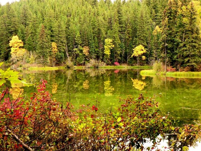
This week's hike to Little Lost Lake is another one of the many trails in the Robson Valley. This trail does not climb to the alpine like the other trails in the area. It is a little known trail that has easy access and is situated in a great location for a quick leg stretcher while you are traveling to other destinations. The short trail through the Western Red Cedars leads to a beautiful lake just below steep cliffs and waterfalls. The falls colors reflecting off the lake make this a great autumn hike.
Directions
Drive 64 km east of McBride, BC on Highway 16 to the parking lot. The highway pullout parking lot is 2.0 km past the Highway 5 turn junction and 700 m past the highway weigh scales. Park on the right side of the road in a highway pullout adjacent to the Fraser River.
Trail Head
There are two trailheads to access the Little Lost Trail. The first access point is from the weigh scales where the trail starts on the north side of the highway. The second and preferred trailhead is from the highway pullout. The trail starts 50 m west of the pullout on the north side of the highway.
The trail climbs for 300 m where it meets the trail from the weigh scales on the left. The trail continues ascending across a creek and through a large grove of cedar and fir trees. After another 1.0 km there is a junction with a trail to the right. This trail leads directly to the two viewpoints on the south facing slope above the lake. Continuing straight ahead for another 150 m will lead to Little Lost Lake. There are two campsites and picnic tables at the lake..
A trail to the left circles the lake for1.1 km where there is another junction. The right fork heads back to the campsite and the left fork heads towards the two viewpoints. There is another junction after 300 m; the right fork heads back to the main trail and back to the parking lot, and the left fork heads up the slope to the two viewpoints.
After ascending steeply for 590 m one more trail junction is reached. The left fork leads 160 m to the west viewpoint of waterfalls. The right fork leads 540 m to the east waterfall viewpoint. Both viewpoints offer scrambling opportunities to climb even higher. In addition to the views of the waterfalls there are also good views of the lake and the Fraser River below.
For more information on this hike including airphotos, maps, GPS coordinates and trail photos refer the book Hiking Central BC which is available at local bookstores.


