
Kibbee Lake
When most people mention the hike to Kibbee Lake, they envision portaging a canoe with a weeks worth of gear for the Bowron Lake Canoe Circuit. The trail to Kibbee Lake can still be hiked without paddling the circuit, just watch out for wayward portagers with canoes over their shoulders. There is also a good chance you will be inspired to plan trip around the Bowron Lakes after watching the many groups of excited people preparing for the circuit.
Directions
From Quesnel, follow Highway 26 for approximately 80 kilometers to the town of Wells, BC. Drive just past the town and turn left at the well-marked turnoff to the Bowron Lakes and drive approximately 30 kilometers on the gravel road until you arrive at Bowron Lake. Once you are at the lake, cross the bridge over the Bowron River and go a further 1.5 km to the parking lot and registration centre.
Trail Description
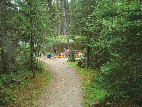
The trailhead is located just past the registration centre on a well maintained path. Stop in at the registration centre and browse through the displays and information on the circuit. The trail winds through a spruce balsam forest on a gentle grade for 2.5 km to the first portage at Kibbee Lake. This end of Kibbee Lake is marshy, narrow, and is a nice spot to view a variety of wildlife. The trail is a great place to take a stroll while exploring the Bowron Lakes' region.
For more information on others hike in this area, including airphotos, maps, GPS coordinates and trail photos refer the book Hiking North Central BC which is available at local bookstores.


