
Black Point Trail
With snow still on our higher elevation trails, the Black Point Hike is a great choice for a lower level trail. It is also one of the few trails in our region that takes advantage of a beautiful shoreline and beach for hiking. It is a short trail but does provide opportunities to explore the shoreline for many more kilometres past Black Point if one is interested. The area around Fraser Lake also has a couple other short trails that can be combined to make a nice day trip.
Directions
From the traffic lights at Domano Boulevard in Prince George, drive 144 km west on Highway 16 to the town of Fraser Lake. Continue 3.3 km past the town and turn left on Francois Lake Road. After 7.2 km turn left on to Nithi Road and follow this for 1.9 km and turn right on to Dahlgren Road. This road follows the lake for 7.4 km to a pullout on the right side of the road. There is enough parking for four or five vehicles in the pullout.
Trail Description
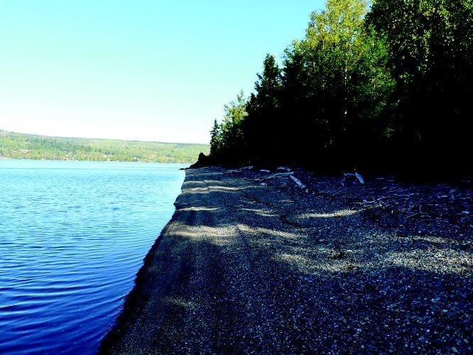
The trail is well marked and heads north through an aspen and dead pine stand. The trail descends very gradually as it winds through the forest for 1.0 km to the shores of Francois Lake. There is an old trappers cabin where the trail enters the beach. The trail now becomes a pleasant walk along the gravelly beach to the east. The large black rock outcropping can be seen jutting out into the lake 600 m further down the shore. There is a picnic table and firepit located adjacent to the point. The rock outcropping continue a further 100 m along the point.
For more information on this hike including airphotos, maps, GPS coordinates and trail photos refer the newly released 2nd edition of Hiking North Central BC which is available at local bookstores.


