
Driscoll Ridge
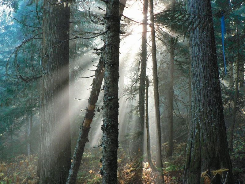
This week's hike to Driscoll Ridge is a loop trail that provides a double dose of hiking through the magical Ancient Cedars of the Interior Cedar Hemlock Forest. The highlights of this hike are the ascending and descending through the towering cedars so take your time to enjoy these portions of the trail. The sub alpine ridge is pleasant with some limited views of the Fraser River below, but this is not a trail for those who are expecting an alpine ridge walk. The trailhead is easily accessed off highway 16 and also provides an opportunity to tour the less strenuous "Ancient Forest" trail.
Directions
From the Yellowhead Bridge in Prince George, drive 108 km east on Highway 16 to start at the main trailhead. Turn right onto a side road with a "Driscoll Trail" sign at the entrance. Drive 113 km from Prince George or 5 km past the main trailhead to start at the Ancient Forest Trailhead. To access this trailhead, turn right into a gravel pit that has a trail sign that reads "Ancient Forest". Drive 50 m through the gravel pit to a parking area near the trailhead. The main trailhead has a few parking spots on the side road, just off the highway. From the highway, hike 250 m up the washed out logging road to a junction. Turn right and hike 50 m until a trail to the left is reached.
The trailhead at the Ancient Forest parking lot starts at the east side of the gravel pit through a forest plantation. The Ancient Forest Trail heads off through the west side of the gravel pit.
Trail Description
The trail is a loop with options of starting at either end to complete the 15.5 km loop. For those wanting to hike to the lake and peak, the main trailhead would be the preferred starting point. Starting at the Ancient Forest trailhead, the trail heads 150 m through a forest plantation before entering a western red cedar forest.
The trail passes a side trail to the Ancient Forest upon entering the forest. The trail winds through the cedars for 1.0 km where it then turns to the right and starts the ascent up to Driscoll Ridge. The trail climbs steeply through cedar, hemlock and sub-alpine fir for a further 3.5 km to the ridge.
The trail winds to the west along the ridge, ascending and descending throughout. After 6.5 km, a small meadow and pond is reached in a saddle between two peaks. The highest point along the ridge is reached after 10.0 km. This peak is one of the few spots along the ridge where the views are not obstructed by trees. There are great views of Caledonia Mountain to the south and the community of Penny to the north. There is a tall green communication tower at the peak as well. The trail to the main trailhead descends down the ridge and turns slightly to the north, through a series of meadows. The south end of a lake is reached at 11.6 km. The trail then descends down some very steep terrain for a couple of km's. The cedar forests are reached as the trail grade becomes more gradual. The trail comes out onto a logging road 300 m from the highway. Turn right onto the road and then 50 m later turn left for the final 250 m down a washed out road to the parking lot.
For more information on this hike including airphotos, maps, GPS coordinates and trail photos refer the book Hiking Central BC which is available at local bookstores.


