
Sunday is “quit smoking” day for Prince George.
That’s when the sky over the city that’s brought wildfire smoke from the western United States is expected to clear.
“A cold front coming through (Saturday) should really help to clear things out,” said Environment Canada meteorologist Doug Lundquist. “By the end of the day tomorrow or early Sunday it should be cleared out.
“The chance of thunderstorms that we’re going to have tonight and tomorrow is really going to clear out that smoke and the flow pattern is changing.”
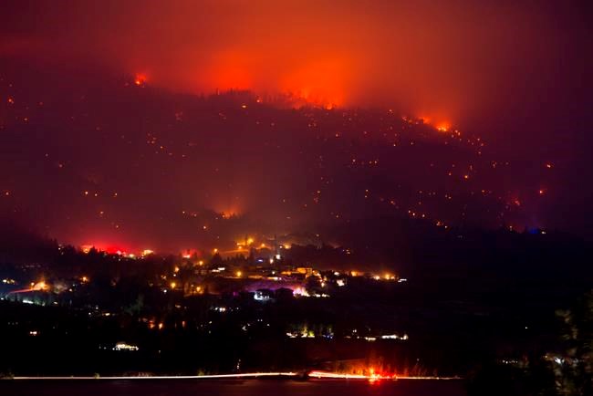
Smoke from fires in Washington, Oregon and northern California that drifted in the B.C., left residents of the southern third of the province gasping for clean air. Friday brought cleaner air from the Pacific to the Lower Mainland, which had been under dangerous smoke advisories for a full week, and by Sunday residents of the Okanagan and Kootenay regions should be able to safely return to outdoor activities after suffering through heavily polluted air all this week.
“It’s rained quite a bit all along the coast mountains and down in the Cascades of Washington and Oregon so I hope they’re getting these fires in control and cooler weather has got to be helping the situation,” said Lundquist.
“From Williams Lake and south was the worst of it and you got a touch of it in Prince George and Quesnel and further up to Terrace and Smithers they saw it up higher in the sky, but not so much on the surface. On the satellite picture it’s really noticeable. The northern edge of it runs to Dawson Creek and just north of Prince George to about Terrace and it’s all clearing off from the west. It’s going to get drawn into a system that will drag it across Canada.”
After overnight thundershowers, more showers are in the forecast for the city Saturday morning, ending in the afternoon, with a high of 17 C expected. The high smoke in the upper atmosphere kept the sun obscured all day Friday, which kept the high temperature five degrees cooler than the predicted high of 21 C.
Sunday will be a cloudy day with a 40 per cent chance of showers in the morning and a high of 16 C, and the city will only reach 12 C on Monday, about three degrees cooler than average. On Tuesday the mercury should rise to 16 C under a mix of sun and cloud, warming to 19 C for a high Wednesday and Thursday, with a chance of showers both days.
The clouds will minimize radiant heat loss and that will help gardeners hoping to keep their flowers and vegetables alive. Overnight lows the next six days are expected to range from 6 C to 10 C. The average low for mid-September is about 3 C.
“The trend is warmer than average for the rest of fall, but not every day,” said Lundquist. “There will be the odd frost thrown in there. It’s fall.”


