
As we all saw, summer was just OK but it looks like fall might see some better than normal temperatures going forward.
"Summer wasn't oppressively hot and it wasn't super cold either," said Erin Wenckstern, meteorologist for the Weather Network.
"We saw around average temperatures throughout the summer. Especially into August it started to heat up a little bit and the beginning of September wasn't as warm as it could be but we're starting to see that heat build over the area and we're going to be seeing temperatures slightly above normal for the remainder of September at least."
But as with all good things, there's always a bit of an equalizer so there will be periods of wet weather, Wenckstern added.
"For the remainder of the fall forecast what we're expecting is temperatures to be just above normal," said Wenckstern, who is located in Ontario where they are enjoying temperatures in the high 20s right now.
"For September through November, temperatures really like to change so it is a transitional season and we see daytime highs going from high teens, low 20s, to around the freezing mark by the time we reach November."
Wenckstern was quick to remind everyone that temperatures during the fall season drop off one to two degrees every week.
Normal temperatures in September average at 17 degrees Celsius, for October it drops to between eight and 10 degrees and November daytime average is about one, she added.
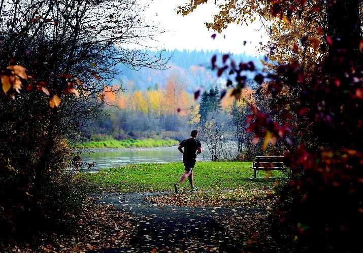
Even though it's a little early, Prince George residents can't help thinking about the colder months since some areas are already feeling the frosty chill in the morning.
"For the winter, temperatures are going to be similar to what you saw in 2013/14 through most of B.C. at least, which was above normal," said Wenckstern. "Of course this is the forecast we're putting out three months in advance for the coming three months after that so it's a little more difficult and we'll have a better idea of what's going to happen when we reveal the winter forecast in late November."
So as early as it is to predict it looks like Prince George can expect to be on the cusp of above normal to near normal temperatures for the winter, she added.
"So what we're expecting is the Pacific Ocean to play a big factor - of course it does every year but this year we have above normal sea surface temperatures south of Alaska, west of B.C. and those are going to be a big factor into keeping B.C. relatively warm over the winter months," said Wenckstern. "So it doesn't mean we won't see below seasonal temperatures and periods of cold, snowy weather but it does mean that maybe over the entire forecast there'll be slightly above normal temperatures."
It's too early for a snowfall forecast but the Weather Network can offer normal averages for December, January, February snowfall that ranges between 30 to 50 centimetres per month.
"Just remember that it comes in waves and sometimes it sticks around and sometimes it doesn't," said Wenckstern.
.png;w=120;h=80;mode=crop)

