
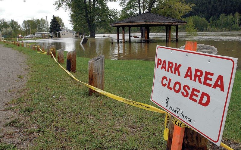
Higher than normal snow packs in the Upper Fraser River and Nechako basins could lead to an increased spring flood risk, according to the province's River Forecast Centre.
Unlike other basins around the province that saw a decline, the Upper Fraser West basin sat at 142 per cent of the normal level while the Nechako basin's level stood at 105 per cent of normal.
"Similar smaller pockets of higher snow packs and potential increased flood risk exist in west central B.C. (Houston, Burns Lake, Vanderhoof) and West Chilcotin," the centre said in a March bulletin.
The snow pack in the Upper Fraser East basin was 98 per cent and 84 per cent in the Middle Fraser basin.
According to the centre, 80 per cent of the province's annual snowpack has normally accumulated by early March.
And with the warmer winter conditions experienced through southern parts of the province this year and more precipitation falling as rain, "rivers across the province have seen well above normal runoff through the winter," said the bulletin. This includes "near historic maximum levels through the Fraser River (from Prince George through Hope)."
But that's a historic high compared to typical winter conditions, explained hydrologist Tobi Gardner.
While it was cool enough for precipitation to fall as snow in the north, the same storms brought rain further south and warmer temperatures have also caused melting of snow in the low to mid elevations.
"Those seasonally high flow levels are more of a result of the warm weather that's happened in the south as opposed to anything wildly different happening in the northern parts of the province," Gardner said.
Looking ahead, the Environment Canada is forecasting a good chance of above normal temperatures through May across the province.


