
RCMP Cpl. Jennifer Cooper has some advice for motorists thinking of heading out onto city streets today.
If those trips are not essential, stay home.
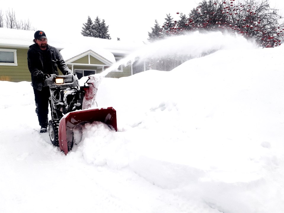
The snowstorm that started Tuesday and continued into today wreaked havoc on city streets that were already slick before the snow began piling up.
Cooper reported 10 motor vehicle accidents police attended Tuesday and early Wednesday morning - five times what usually occurs on a winter day in the city.
“It’s a pretty serious winter storm,” said Cooper. “The wind isn’t howling but the amount of snow is definitely problematic and we should be taking that into account and not just going about our daily business as if there’s nothing changed.
"We still have a thick layer of ice underneath all of this snow and that hasn't gone anywhere. We were all suffering with the icy conditions before this snow fell, so now it's just slippery snow on top of slippery ice, giving you no grip and your stopping capabilities change as a result of that."
Cooper said highway travellers should pack food, water, extra blankets and plenty of winter clothing in their cars with them in case they slide off the highway into a ditch or come upon an accident scene that closes the road. She also advised keeping your fuel tank topped up, cell phones charged and for drivers to take advantage of new technology that allow emergency text messaging to satellite systems now available on some newer cell phones.
Drivers and pedestrians were probably uttering a few curse words under their breath during the morning commute as snow continued to pile up. The deep snow on top of a layer of ice made walking difficult and motorists got stuck in their driveways or residential streets where city snowplows haven’t had a chance to clear the way. City crews give top priority to major streets, the downtown core, the hospital area and school bus routes.
The City of Prince George issued an advisory Tuesday that city bus service might be affected by the storm. Go to the website for updates and real-time tracking on city routes.
Canada Post issued a red alert for Prince George Wednesday which suspended all deliveries. They will not be sending any delivery agents and will be recalling those who already began their delivery shifts until conditions improve and it’s safe to do so.
For highway travelers, road conditions were treacherous and drivers are being advised to stay home or delay those trips if possible, with an additional 10 or 15 centimetres of snow expected today for the region to add to the 12-16 cm total from Tuesday.
Wind gusts up to 40 kilometres per hour are in the forecast for today and Thursday, which could reduce visibility for drivers. Cooper said motorists should drive according to the conditions and drive below the speed limit if it is slippery. She warns erratic drivers will be ticketed if spotted by police patrols.
Prince George is heading for a high of -4 C today and a low of -9 C.
Environment Canada forecasts the snow to end Thursday morning as we head into a bit of warming trend for late in the week, with above-freezing temperatures predicted for Thursday (1 C), Friday (3 C), Saturday (5 C) and Sunday (3 C).
“It will be milder in temperature and that will mean we will see the chance of rain returning Thursday night or Friday morning,” said Environment and Climate Change Canada meteorologist Derek Lee. “It is getting warmer but thing may get messy because of the rain or snow possibly happening.”
Friday could bring rain or snow but for Saturday and Sunday there’s no precipitation expected under a mix of sun and cloud both days. That could make for ideal conditions for tobogganing, downhill skiing/snowboarding, skating, snowshoeing and cross-country skiing this weekend.
January’s mean temperature was -4 C, almost four degrees warmer than average (-7.9 C), and that made it the 10th warmest January on record. Precipitation was 64 per cent of normal. We usually get 53 millimetres in water equivalent precipitation and we received just 34 mm.
Lee said the start of February will likely be warmer and wetter than normal. Long-range forecasts point to colder-than-average days late in the month.


