
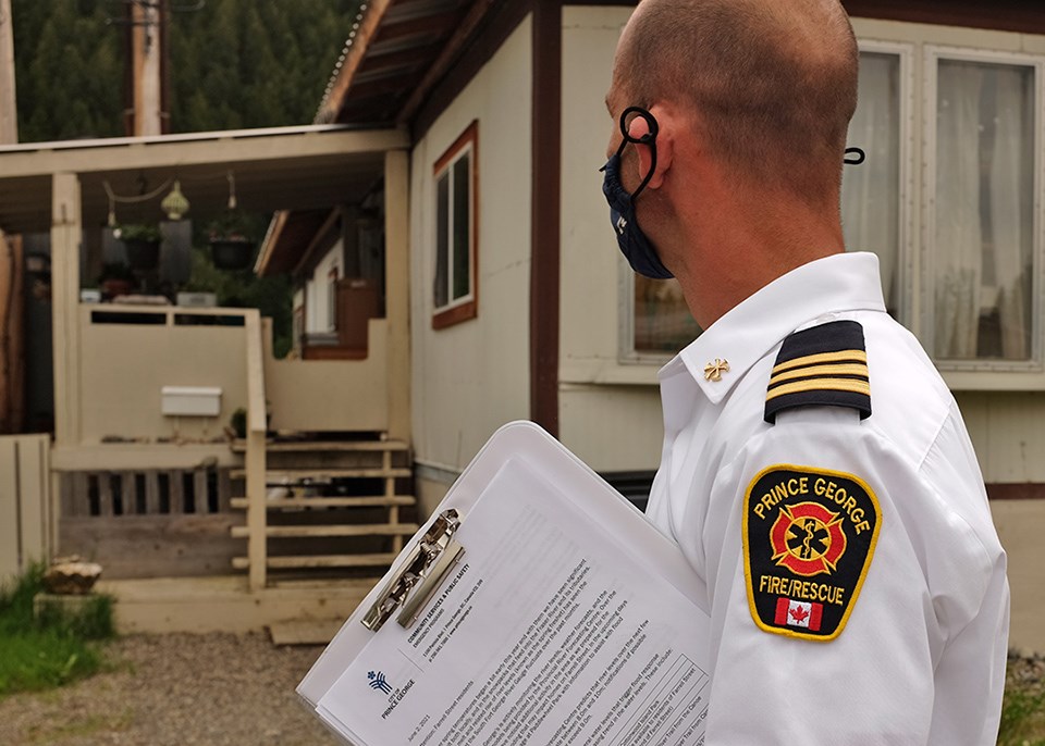
The city is warning residents of Farrell Street near Paddlewheel Park in South Fort George of the risk of flooding as water levels in the Fraser River rise.
No evacuation alerts or orders have been declared for Prince George yet.
But according to the Province of BC's River Forecast Centre, water levels on the Fraser River are at about 8.4 metres, as of noon today (June 2) and are steadily approaching 9.0 metres with the river forecast to rise over 9.5 metres by the weekend.
Homes basements on Farrell Street may start to experience flooding when the river begins to exceed about 9.0 metres.
The city has also activated its Emergency Operations Centre and staff delivered letters to Farrell Street residents advising them to be prepared to evacuate should evacuation be required.
Sand and sandbags are available to residents of Farrell Street and are positioned at the north end of the street.
Residents in the area are also strongly advised to have an emergency kit readily available to enable them to leave their properties quickly in the event of an evacuation order.
On May 20, the city announced the closure of sections of Heritage River Trail and Cottonwood Island Park due to the rising water levels from both the Nechako and Fraser Rivers.
The Heritage River Trail is still closed from the trailhead east of the riverboat launch to Taylor Drive north of Lheidli T’enneh Memorial Park. All three bridges in Cottonwood Island Park are also closed, as is the road into the canoe launch.
However, Nechako Riverside Park, McMillan Creek Fishing Park, Paddlewheel Park, and Hazelton Park remain open at this time.
The city says staff are continuing to monitor the river levels and encourages residents to use caution whenever walking near the rivers, particularly during periods of increased water levels.
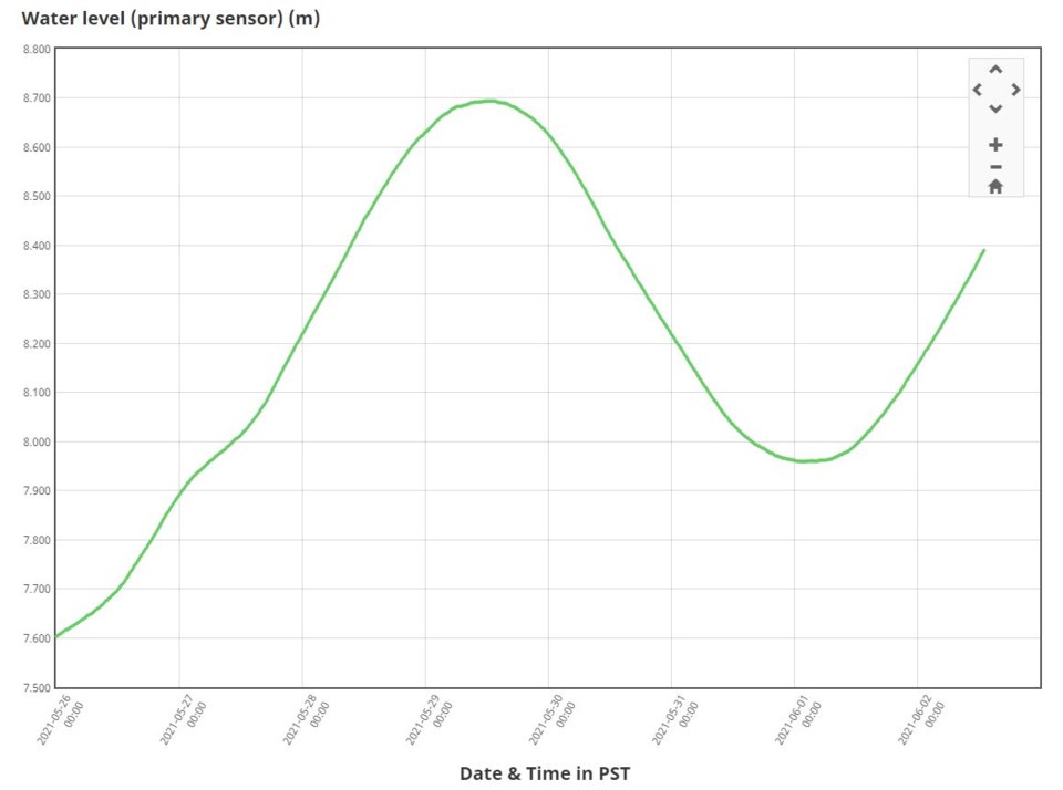 Real-Time Hydrometric Data Graph for Fraser River at South Fort George at June 2 at 1 p.m. By Government of Canada


