
In a city-wide evacuation scenario, wildfires, flooding, or otherwise, officials are going to make sure that everything goes smoothly.
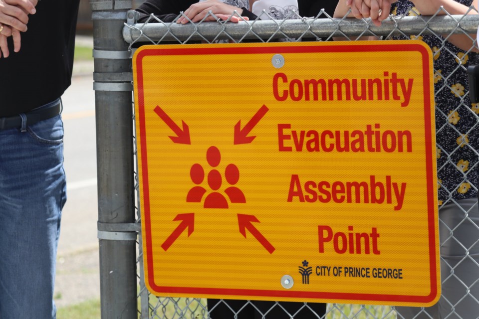
The next step towards that possibility has been taken by the City of Prince George, setting up evacuation assembly point signs at 18 schools, including Van Bien Elementary school on Upland Street in the above pictures, with more innovative ideas in store.
It all started with an emergency preparedness drill in May on a 900 sq. ft table-top map of the city, which helped City Manager of Emergency Programs Adam Davey realize what was needed to help lessen the difficulty of evacuating residents.
“One of the big pieces of the new evacuation plan includes community evacuation assembly points,” Davey said to PrinceGeorgeMatters. “We’ve identified 18 strategic spots around the city where folks without the ability to drive, but the ability to walk to in the event of an evacuation, might be able to collate at so we could then pick folks up on a bus.”
In the memorandum of understanding Prince George has with School District 57 (SD57) in this initiative, four of the muster points are at schools in the Hart, four in College Heights, and 10 directly in the city, including four of the five major secondary schools.
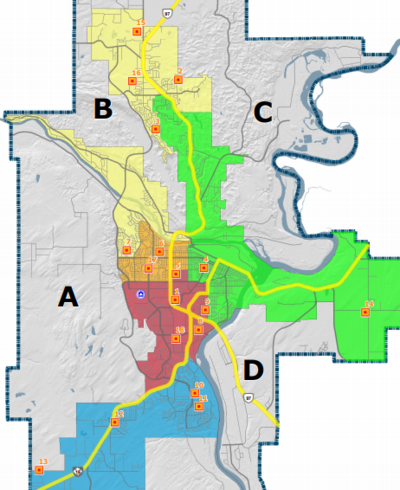 The yellow squares indicate muster points during an evacuation (via City of Prince George)
Davey explains the criteria when picking and choosing the community evacuation assembly points were three-fold.
“Walkability, based on the density of the local neighbourhood; the ability to actually be able to bring buses and support folks at those locations, and we just wanted to make sure [the assembly point signs] were strategically located. So, some schools are on the west end of town, some are in the north, and then the majority are throughout the main area of the city.”
Within a month of the using the big table-top map, the city then introduced a new efficient registration system for evacuees once they’ve been relocated to Prince George.
Now, according to Davey, the city has plans to put together a new application system so evacuees and local residents can access maps, routes, and services through their electronic devices.
“We’ve revived and now finalized our evacuation plans, so we’re actually looking to putting it into a user-friendly version so people can be able to access it via a smartphone. We’re working on it now, but we’re hoping to have it now in the next couple of months. We’ve had some technical challenges, so we’re just working through those now.”
Until it’s ready for public use, Davey encourages everyone to be prepared for the possibility of an evacuation, which includes a 72-hour emergency kit for each individual in a household.

