
A flood watch has been issued by the BC River Forecast Centre for Prince George and other parts of the Central Interior as a slow-moving low-pressure system brings heavy rain and raises the risk of flooding across the region.
The BC Ministry of Water, Land and Resource Stewardship says river levels are expected to rise significantly in the days ahead with peak flows likely between Sunday and Monday.
Hydrologists warn that, in some areas, water levels could approach or exceed levels seen once every 5 to 20 years — or even higher in worst-case rainfall scenarios.
The River Forecast Centre has issued or maintained flood watches for several regions including the Upper Columbia, East Kootenay and the Middle Fraser and Chilcotin areas, which includes tributaries draining from the Coast Mountains east of Williams Lake and Lillooet.
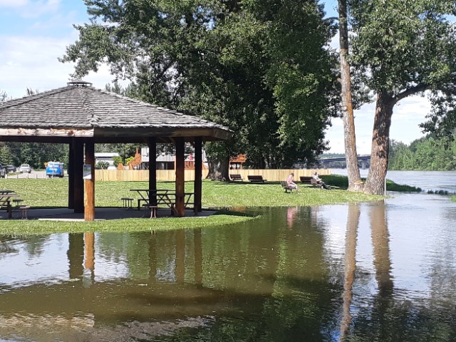
A high streamflow advisory is also in effect for the Upper Fraser, including the Prince George area, as well as the Peace Region, South Thompson, Nicola, West Kootenay, Okanagan and Similkameen.
While river levels in the Upper Fraser are currently near seasonal norms, recent snowmelt and earlier rainfall have left waterways running higher than usual, the centre states. Forecasters say the expected rainfall could tip some rivers close to or over their banks, especially in mountainous areas where upslope rainfall can amplify precipitation totals.
The weather system, which began pushing into BC from Alberta on Friday, is bringing highly variable rainfall to southern and central parts of the province. Rain is forecast for Sunday, with a chance of additional precipitation on Monday.
The River Forecast Centre notes there is still "high uncertainty" around how much rain will fall and exactly where, but says residents in flood-prone areas should be prepared and stay alert for updates.
A special air quality statement related to wildfire smoke issued by Environment Canada Saturday was still in effect Sunday morning.
Prince George forecast
- Sunday, June 22: Chance of showers, high 23 C, 30 per cent chance of precipitation. Sunday night: 60 per cent chance of showers, low 10 C
- Monday, June 23: Clearing, high 22 C
- Tuesday, June 24: 40 per cent chance of showers, high 20 C
- Wednesday, June 25: Cloudy, high 20 C
- Thursday, June 26: Sunny, high 19 C
- Friday, June 27 and Saturday, June 28: Mix of sun and cloud, highs around 22–23 C


