
Flooding appears to be on its way as warmer-than-usual weather will continue to work away at the remaining snowpack in area mountains.
The high water flowing through the upper Fraser River has the potential to reach the "flood stage or above" by this weekend with a similar outlook downstream for Quesnel, River Forecast Centre head Dave Campbell said during a teleconference Monday with the province's media.
"Certainly the next seven to 10 days or even two weeks is going to be critical for Prince George-Quesnel areas," Campbell added.
The province is heading into its fourth week of extreme heat and daytime highs in the city forecast to run about 10 C above normal over the coming days. The heat so far has been enough to melt away the lower-elevation snow, but about half the mid-level accumulation remains and the hot weather has put just a 10-per-cent dent in the upper snowpack.
"Without a doubt this is an extreme weather event with respect to the heat and certainly concerning for the potential for the snowmelt from the weather," Campbell said.
The city's emergency operations centre was activated on Friday and put on a "state of readiness."
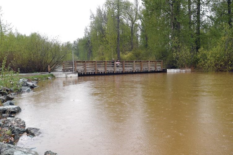
No warnings, alerts or evacuation alerts have been issued by the city as of Monday, but a section of the Heritage River Trail from the canoe launch at Cottonwood Island Nature Park to Taylor Drive has been closed, and both the island in Cottonwood Island Park and Paddlewheel Park remain off limits.
Further afield, 39 homes along Upper Mud Road west of the city remain on evacuation alert and the Fraser-Fort George Regional District is advising them to be ready to leave at a moment's notice.
For the Bulkley-Nechako, Campbell said this is the critical week barring any extreme rainfall.
"We're on the cusp there of having enough snow to push things higher than we've seen so the potential is very much there," Campbell said. "Going forward beyond this week, we will have melted out that snow so I think this coming five days or so is the critical window."


