
VANCOUVER — Lightning strikes have peppered British Columbia's southern Interior, raising wildfire concerns as yet another day of heat warnings blanket most of the province and the wildfire risk jumps to high or extreme.
Environment Canada's lightning danger map shows dozens of strikes early Friday in the Kamloops, North Thompson, Shuswap and North Columbia regions, while the BC Wildfire Service map shows a handful of small fires sparked since midnight, although the cause of each fire is under investigation.
The weather office is calling for temperatures up to 40 degrees for many parts of the southern Interior and 14 daily maximum temperature records were broken Thursday.
The southern Okanagan community of Osoyoos reached 41.2 C, tying a record it set for the day in 1996 and edging the village of Lytton by one-tenth of a degree for hottest place in Canada.
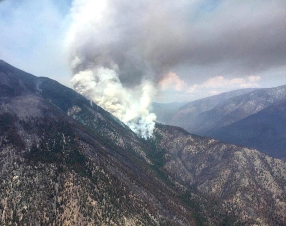
The BC Wildfire Service says high temperatures around the wildfire burning out of control west of Lytton pushed the flames to the entrance of the Stein Valley Thursday, and increased fire activity is expected to continue as the hot, dry spell drags on.
The fire is now estimated to have charred nearly 27 square kilometres in the two weeks since it was discovered, but the wildfire service says rocky slopes and sparse fuels have slowed its growth and flames are not spreading further west into the Stein Valley.
As heat dries out the backcountry, the River Forecast Centre warns the conditions are also having an effect on B.C. waterways.
"Hot temperatures early this week have triggered significant snowpack and glacier melt at the high elevations of the Chilcotin Basin," the centre says in a statement posted Friday.
A flood watch has been issued for the Chilcotin region including the Chilcotin and Chilko rivers and their tributaries as the centre says flows are "slightly over the 10-year return period level and are expected to rise further into the weekend."
A flood watch is also in effect for the Lillooet River near Pemberton and high streamflow advisories cover waterways in the Sea-to-Sky region as well as the Upper Columbia in southeastern B.C., and the Nechako basin west of Prince George, although the centre says levels of rivers and streams there are falling.
This report by The Canadian Press was first published July 29, 2022.
The Canadian Press


