
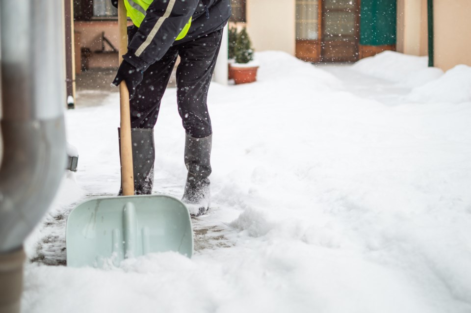
Environment Canada has issued snowfall warnings for 17 regions across B.C. as a low-pressure system off Vancouver Island draws cold arctic air from the province’s interior.
In parts of Greater Victoria, the clashing systems could drop up to 10 centimetres through Monday evening and into Tuesday morning, warns Environment Canada. Similar snowfall warnings are in place for the east coast of Vancouver Island.
“Vancouver Island can see snow in November, it’s not out of the question,” said Environment Canada meteorologist Bobby Sekhon.
“That being said, it is fairly early in the season to be getting snow.”
On the mainland, the Fraser Valley is expected to receive between 10 and 20 centimetres of snow — along the Coquihalla Highway from Hope to Merritt and on Highway 3 between Hope and Princeton.
Similar snowfall totals are expected in the Similkameen, Nicola, South Thompson, 100 Mile, South Okanagan, Boundary, West Kootenay and Kootenay Lake regions.
The offshore low-pressure system is expected to move south through Monday, cutting off the snow's supply of moisture, said Sekhon.
Arctic outflow could drop windchill to -20 C in places
Environment Canada has also issued a wind warning for the southern areas of Howe Sound, including Bowen Island, telling those in the area to take precautions as winds could gust up to 90 kilometres per hour.
Environment Canada is warning the high winds could toss loose objects and snap tree branches, leading to power outages. Sekhon says windchill could drop temperatures down to minus 10 Celsius overnight Monday.
“Even in the Lower Mainland, we’re going to see cold temperatures close to or below freezing for most of the week,” said the meteorologist, pointing to a change of wet flurries over the next 24 hours and a low of minus four Celsius in the Fraser Valley Wednesday night.
“Very strong” arctic outflow winds gusting to 110 kilometres per hour are also expected to hit the central and north coast through Tuesday morning.
The region’s inland sections are expected to see winds up to 60 kilometres per hour, with windchill temperatures dipping to -20 C through Wednesday morning.
“Anyone who is not dressed warmly is at risk of frostbite and hypothermia in cold weather,” warned Environment Canada.
B.C.'s cold shift expected to continue
Fall weather dominated by hot and dry conditions has turned drastically in recent weeks after a series of low-pressure systems swept in off the Pacific Ocean.
“It’s been an overall pretty quick shift from almost summer-like conditions to almost winter weather,” said Sekhon.
While more typical for this time of year, the cold conditions are expected to be increasingly less common. On Monday, a real-time model gauging the fingerprint of climate change on local temperatures found a strong signal across much of B.C.’s coast.
The real-time climate attribution model, produced by the research group Climate Central, found human-caused climate change made today’s cool weather up to five times less likely.
Climate change is not the only long-count climatic influence on B.C.’s seasonal trends.
La Niña and El Niño are used to describe warm and cool phases of a climate pattern that shifts across the tropical Pacific every three to seven years. As sea surface temperatures swing back and forth between Australia and South America, the cyclical El Niño Southern Oscillation (ENSO) phenomenon causes knock-on effects that disrupt temperature and precipitation patterns thousands of kilometres away — often in somewhat predictable ways.
In B.C., a cycle dominated by an El Niño pattern tends to lead to warmer winters, whereas a La Niña winter tends to be cooler.
For a third straight year, ENSO is forecast to swing in La Niña's favour, delivering a colder-than-usual winter to some parts of North America.
Last month, NOAA’s Climate Prediction Center said there is a 75 per cent chance of La Niña between December and February.
Sekhon said preliminary models indicate temperatures could remain below average for the rest of the fall — an early sign of La Niña’s chilling influence.
“We can’t forecast any individual events,” warned Sekhon. “Look out for those weather warnings.”
“We’re going to want to stay prepared.”

