
A witch's brew of snow then rain struck the city on Thursday - and icy conditions are expected to follow today.
Roughly 10 centimetres of snow - much of it in the form of large, white dollops - descended on the city over the morning only to give way to rain in the afternoon as the temperature rose above freezing, creating a soupy mess.
Things won't get any more pleasant.
An Arctic cold front was on its way, Environment Canada meteorologist Doug Jones said Thursday afternoon, and with it a high of -5 C for Friday then deepening into the double digits overnight.
"And then it's going to gradually warm up through the weekend," he said. "The reason behind that is we're getting a temporary blast of Arctic air that's maybe one day long and then we get the fulcrum more of the Pacific and it'll try and warm things up."
By Monday, the high is forecasted to be 3 C.
In the meantime, be careful out there. Walkers will be contending with icy sidewalks and drivers with slippery roads. Motorists should check the DriveBC website for updates before venturing onto area highways, Jones advised.
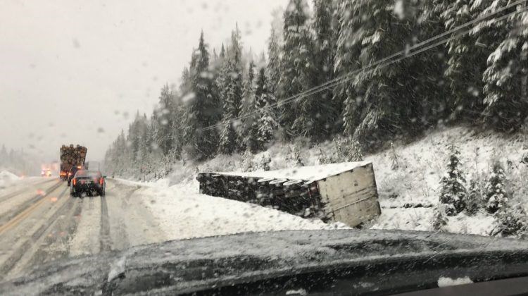
The conditions led to one major incident on Thursday as a transport truck pulling a trailer went off Highway 97 about 10 kilometres north of Quesnel. The stretch was closed in both directions for part of the morning before it was gradually reopened to single-lane alternating and then, by 2:30 p.m., completely reopened.


