
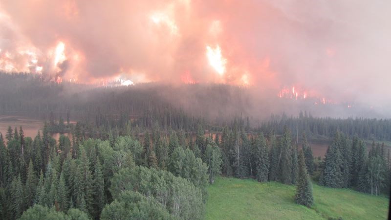
There are eight wildfires of note in the Prince George area due to their visibility or potential threat to public safety, according to bcwildfire.ca.
In the Prince George Fire Centre:
22 km Tenakihi
Euchiniko Lakes
Forrest Mountain Fire
Mount McAllister Fire
Mugaha Fire
Red Deer Creek Fire
Salmon Lake Fire
Valley south of Morfee Lake
There are more than 400 firefighters working on the fires, with more crews coming from across the country to join the battle.
In the 22 km Tenakihi, about 50 kms west of Williston Lake, between the Mesilinka River and Tenakihi Creek the fire has grown to 22,000 hectares and was discovered on July 8. The fire is very active and expected to grow. It was caused by lightning. There is one helicopter being used to combat the fire.
Euchiniko Lakes, 120 km west of Quesnel, 7,000 hectares are involved. It is an active fire and was discovered July 8. Crews and heavy machinery are working to establish guard and contingency lines around the fire.
Due to strong winds in the area and aggressive fire behaviour, further growth occurred and it crossed the 4000 road. Firefighters and heavy equipment are continuing to establish contingency lines and primary guard, burn off fuel where conditions are good, and commence with mop-up. Conditions will continue to challenge crews with the hot dry weather, and smoky conditions have made it difficult to determine an accurate size. The fire was caused by lightning.
The fire is currently on the border between the Prince George Fire Centre and the Cariboo Fire Centre. All resources are being coordinated through the Prince George Fire Centre.
Resources include:
120 firefighters
10 helicopters
30 heavy equipment
Additional Incident Management Team personnel have been brought in to assist with planning and operations.
Helicopters are continuing to bucket the fire to support ground crews. Crews are working on establishing contingency lines, continue establishing primary guards with equipment, and burn off fuels where conditions allow.
Forrest Mountain Fire, 50 km Northwest of Williston Lake, was discovered on June 2 and engulfs 5,000 hectares. This fire was caused by lightning and is producing a lot of drift smoke that can be seen in Mackenzie and Dawson Creek. The fire will be actively monitored but not actively suppressed. If the situation changes then limited action may occur on the fire.
There are currently no structures or resources at risk at this time.
Mount McAllister Fire, 56 km West of Chetwynd, began July 13 and covers 16,000 hectares. The obective for this fire is to protect life and property. It conditions permit, controlled burn off will be used to control the advancement of the fire. Structure Protection experts will be protecting infrastructure. The District of Hudson's Hope has rescinded their evacuation order. AN ALERT REMAINS IN PLACE.
The Peace River Regional District has ordered an Evacuation Alert for residents in the community of Moberly Lake and surrounding area extending to the northernmost point of Boucher Lake Road, directly west to the Klin-Se-Za protected area, north along Carbon Creek to the southern edge of Williston Lake directly east to the boundary of Hudson's Hope. Info: www.prrd.bc.ca
Mugaha Fire, 8 km up Mugaha Creek, began July 12 and covers about 185.0 hectares. The fire was caused by lightning.
Resources
50 firefighters
3 helicopters
3 heavy equipment
Crews are working hard to build guard on the west end of the fire to prevent it from moving back down the Mugaha drainage. Progress is going well and winds are continuing to push the fire east.
Red Deer Creek Fire, 61 km Southeast of Tumbler Ridge, was discovered July 6, and covers about 34,827.0 hectares. It is an active fire and was caused by lightning. This fire is located within British Columbia and Alberta. The objective is to hold the fire south of the Heritage Highway in British Columbia and west of the Two Lakes Road in Alberta.
There are oil and gas values in the vicinity of this fire. Currently structural protection units have been set up on three oil and gas camps and four bridges.
Evacuation Order is in effect, affecting 200 people.
Three oil and gas work camps have been evacuated. The Alberta Incident Management Team has taken over this fire.
Resources
115 firefighters
25 helicopters
36 heavy equipment
0 airtankers
There are 99 BC firefighters working on the portion of the fire in BC and 16 Alberta firefighters working in Alberta. There are 19 helicopters working in BC and 6 working on the Alberta side. Twenty seven pieces of heavy equipment are working in BC and nine in Alberta.
Salmon Lake Fire, 37 km northeast of Tezzeron Lake and covers about 1,440.0 hectares and was caused by lightning. There are cabins near the fire. There are no residents within the cabins. Crews and aircraft are working to protect the property.
The crews have been making good progress with burnoff procedures on the northeast side and south side.
Resources
20 firefighters
4 helicopters
10 heavy equipment
A type 2 incident management team is in place for this fire.
Heavy equipment is working during the night to build guard during less intense fire activity.
Valley south of Morfee Lake, 6 km east of Mackenzie, was discovered July 12 and covers about 180 hectares, is active and 75 per cent contained. The fire is currently burning uphill in an easterly direction.
Resources
20 firefighters
2 helicopters
3 heavy equipment
Crews are making good progress on the on the southwest and northwest edge of the fire and they are working towards the east.


