
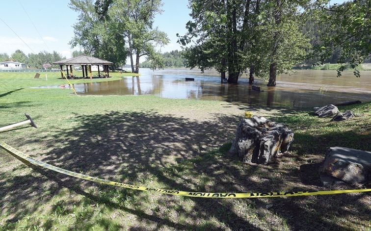
Flooding the likes of which the city has not seen in 46 years could be on its way.
The reigning combination of hot weather and abundant snowpack in area mountains is in shape to push the the amount of water rushing down the Fraser River "into 1972 range of potential flows by next week," River Forecast Centre head David Campbell said Thursday during a teleconference.
To reach that point, the hydrometric gauge at South Fort George would have to strike 10.4 metres. As of Wednesday, the day after the city issued an evacuation alert to 18 homes along Farrell Street, it had creeped up to nine metres has been rising at a rate of 10 centimetres per day. Flooding typically begins in the area when it strikes 9.4 metres - which was also the peak in 2012.
"Right the way down, the Fraser has been rising," Campbell said. "We saw Saturday to Wednesday temperatures of eight to 10 degrees above normal, in many cases. That really cranked up the snow-melt rates in the headwaters.
"We've seen that melt coming down. It hasn't fully worked its way down into the upper reaches of the Robson Valley and into Prince George so we still have a good two or three days of rise just from that slug of water coming down as it is, so we expect that to continue to rise into the weekend.
"And then as we go into the weekend there is more hot weather, more melt, and we expect we could get up higher than that next week, so we're starting to get into above-2012 levels and more into 1972 range of potential flows by next week."
The flood of 2008 got to 9.7 metres and the flood of 2007 peaked at 9.86 metres.
To give some context, the same gauge showed Fraser River levels at 3.3 metres on March 1, it was 3.5 metres on April 10, then climbed steadily as the river always does in spring. It passed the 6-metre mark on April 25, and in less than five days had climbed a full metre. Five days after that, it was at 7.5 metres and that's when the swelling really began.
Three factors played a role in this environmental circumstance.
First, a large pile of snow accumulated over the course of the winter. In the Upper Fraser watershed, it was above average by a few percentage points.
Then, early spring was colder than usual and that retained the snowpack in an unusual way. The Upper Fraser snowpack was more than two-and-a-half times its normal amount on May 1 due to the gradual early-seasonal melt that did not happen.
Thirdly, that big dollop of snow is now getting baked by a heat wave that is not typical for this time of year. That means a cascade of water is being dropped from the mountaintops into the valleys below.
This amplified freshet is happening in many regions of the province simultaneously. The Okanagan, Similkameen and Boundary areas are getting hit with floodwaters right now. Places like the Shuswap, Kootenays and Prince George-Cariboo are soon to join them.
The good news, according to Campbell, is the snowpack has been greatly diminished by this warmth. The possibility for flooding in late spring / early summer is greatly reduced.
Officials warm the public to stay well away from moving water. Riverbanks are unusually unstable due to unprecedented erosion, and the currents are extraordinarily strong and unforgiving. Local government in the Prince George/Upper Fraser areas will update the public on a regular basis on floodwater conditions throughout the weekend.


